|
Trip Day:
|
126
|
Latitude:
|
44°39.58 '
N
|
Locks Today:
|
0
|
|
Miles Today:
|
8
|
Longitude:
|
079°23.10' W
|
Locks Total:
|
81
|
|
Total Miles:
|
2,510
|
Location:
|
Midland, ON – Bay Port Marina
|
||
Brown Eyed Girl and Kismet are also here - unfortunately these boats are here for repairs after hitting rocks. Brown Eyed Girl has to have a new shaft and props and Kismet also requires fiberglass work to repair a large gash.
SATURDAY, JULY 14TH - PENETANGUISHENE ON
|
Trip Day:
|
125
|
Latitude:
|
44°47.94 '
N
|
Locks Today:
|
1
|
|
Miles Today:
|
21
|
Longitude:
|
079°56.10' W
|
Locks Total:
|
81
|
|
Total Miles:
|
2,502
|
Location:
|
Penetanguishene, ON
|
||
 Locking through the last lock and bridge of the Trent-Severn Waterway was bittersweet—hate to be leaving the TSW, but looking forward to Georgian Bay. Passing under this bridge gave us our first glimpse of Georgian Bay and what a nice welcome she gave us.
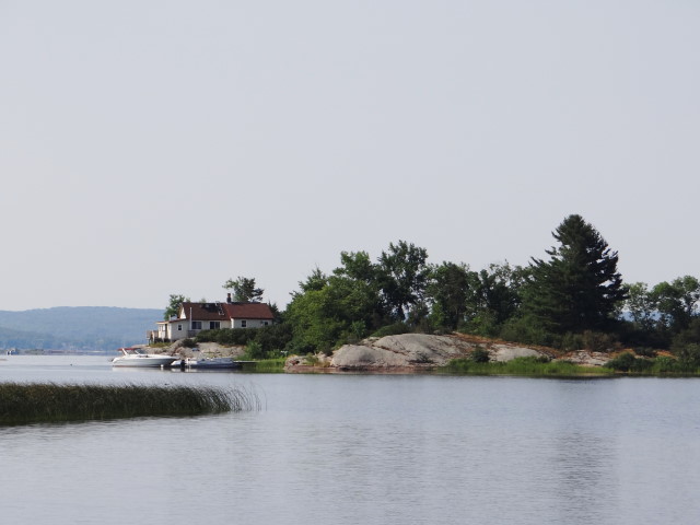
As we wound through narrow channels following the marks we awaited the open water and, since it is Saturday, we were not surprised to see boats of all sizes headed out for a day of fun on the water. It did not escape Ron’s attention that there were sailboats with their mast in a vertical position and under sail—just a couple more days and our mast will be upright again.
 We passed Snake Island, Present Island and Peekaboo Point as we rounded into Penetang Harbour to Penetanguishene where we went ashore to tour Discovery Harbour, which is the site of the Naval Establishment of the War of 1812. Georgian Bay area will be hosting numerous events to celebrate the Bicentennial of the War of 1812.
Since Canada was still a province of Great Britain, it was used as staging area for the British troops during the War of 1812. Replicas of the structures on the original base were on display including officers’ quarters, commanding officer’s and the Fort Adjutant homes.
The
H.M.S. Tecumseth was an armed transport schooner stationed at this naval base from 1816 to 1828—by the time it was launched, the war was over. The replica of this 70ft schooner was well done—the most intriguing feature was the tiller steering station (there was no wheel).
The British hydrographer, Henry Bayfield, worked from this base when he surveyed Lake Huron for the British Navy. 

FRIDAY, JULY 13TH - THE BIG CHUTE!
|
Trip Day:
|
124
|
Latitude:
|
44°51.51 '
N
|
Locks Today:
|
1
|
|
Miles Today:
|
4
|
Longitude:
|
079°42.64' W
|
Locks Total:
|
80
|
|
Total Miles:
|
2,481
|
Location:
|
Gloucester Pool
|
||


The Big Chute, lock 44, is the most unique and hair-raising experience on the Trent-Severn. It is not technically a lock, but actually a railway lift, with a 58 ft drop, over the land between the Upper Severn River and Gloucester Pool. The Big Chute railway portages vessels across land and down the chute on twin tracks. There are two different stories for the railway portage versus lock portage. One story is that there was no concrete available for a standard lock and the railway was cheaper. The other was to prevent lamprey-a parasitic, eel-like fish with a jawless, sucking mouth from attaching itself to other fish and damaging the fisheries in Lake Simcoe.
We arrived at The Big Chute early, tied up to the dock and went ashore to watch operation before venturing across ourselves. As we approached the dock Ron spotted The Tarquin which is the trawler owned by Sandi and Eddie from Bradenton whom we met before we left Sarasota.
 This is the first time our paths have crossed and it was so exciting to talk with them—we will most likely meet again in Georgian Bay.
We watched a couple of boats pull into the submerged rail platform, lifted on slings as it rose out of the water, transported across the land and down the slope, then drive into the lake once the platform was submerged again.
And then it was our turn . . . We drove into the open-air carriage and rested on our hulls with no straps as we slowly made our way across the street, and down the chute, one cog at a time. The ride took about 10 minutes and was stable, but the sounds of the squeaking cables and pulleys and unidentified grinding sounds made for an exhilarating ride.


Looking back as we motored away, we wanted to turn around and go through again, but the Betty L and KatMan2 were waiting for us so we could move on down the river.
Traversing through the tree-lined narrows of granite we were rewarded when it opened up to yet another beautiful area with little islands and cottages and boats of all sizes. We followed the Betty L into a little cove off a Canadian public park. We spotted a tent camper tucked back into the trees very near our anchorage. As soon as the hook was set we were in the refreshing water, Jean jumped in with her clothes on, then we all floated around on noodles chatting about the day.
While we had dinner on the Betty L, a helicopter landed just beyond our anchorage causing much speculation about which hockey player had a weekend home here, or perhaps it was a rock star!


No comments:
Post a Comment