Tuesday, July 31, 2012

BRUCE MINES - MOST NORTHERN POINT

MONDAY, JULY 30TH  -  BRUCE MINES, ON


Trip Day:
   141
Latitude:
  46°17.85' N 
Locks Today:
  0
Miles Today:
     28
Longitude:
083°47.40' W
Locks Total:
81
Total Miles:
2,869
Location:
Bruce Mines Marine Park


As we sailed today, a RED LINE appeared on the chart plotter, marking the division of Canada and US waters.   This is our most northern point in our adventure:  46° 17.85’ N.


It has been another week of gunkholing, so we pulled into Bruce Mines Marine Park for the night.  The afternoon was filled with those weekly chores of laundry, beer bottle return and grocery shopping.  It was necessary to sit at the Bavarian Restaurant later in the day to spend the last of our Canadian money.  With a big screen TV in front of us we soaked up the London Summer Olympic coverage and enjoyed the banner with the wait staff. 


As predicted, the rain began early in the evening and lasted past midnight, a fitting end to our stay in Canada.  We entered Canadian waters on June 29th and will be leaving tomorrow, July 31st. 

In  past years some boaters have had severe weather in North Channel, but knock on wood, the weather has been delightful.  We thoroughly enjoyed our experiences and 682 miles in  Georgian Bay and North Channel, but must  admit we are ready to get back to the good ole US of A!


Monday, July 30, 2012

EAST GRANT ISLAND, ON CANADA

SUNDAY, JULY 29TH -  GRANT ISLAND


Catch of the day—

one more Northern Pike in the calm of our anchorage at quiet John Harbor.

 A little after eight we raised anchor and headed west into Whaleback Channel, which is seven miles long and would be good sailing, but there is no wind this early. 


Another chance to do a day visit to a town, then anchor out for the night.  Today we visited Blind River—the metropolis of the North Channel with a population approaching 4,000.

Appropriate to its logging history the town houses the Timber Village Museum, but unfortunately it was closed today.  We rode our bikes downtown,  through neighborhoods and along the waterfront greeting people as we passed. 

 Leaving Blind River, we headed west with light winds making it very comfortable to cross open water to the Grant Island. 

Ron braved the cool water, but Jean chickened out and stayed onboard.  There is only one other boat in the protection of the cove—just enough wind to keep the bugs away—quiet and peaceful—beautiful sunset to end the day . 


Sunday, July 29, 2012

GORE BAY and JOHN HARBOR

SATURDAY, JULY 28TH  -  JOHN HARBOR


Trip Day:
   139
Latitude:
  46° 08.00' N 
Locks Today:
  0
Miles Today:
     31
Longitude:
082°36.98'W
Locks Total:
81
Total Miles:
2,805
Location:
John Harbor Anchorage

A nice-sized bass decided to join us for dinner tonight as the guest of honor.  We wish his brother had come along, but he was the one to accept our invitation. 

Since we anchored on the south shore of the channel last night, we motor sailed another 14 miles to Gore Bay to check out the area.  The marina allowed us to tie up long enough for a walkabout on main street and lunch at a little cafĂ© advertising three dollar beer.  Unfortunately the town museum was closed so our visit was short but lunch was good and the weather was perfect. 

 Leaving Gore Bay we headed northwest to cross to the north shore of the North Channel.  The winds were light making an easy crossing of wide-open water with no land in sight for a few miles, then the island ranges came into view.  Boat traffic was fairly heavy since it was Saturday with a lot of white sails visible against the dark outline of the hills. 

The selected anchorage for the night was the protected waters between the large John Island and the small Dewdney Island which would put us in position for a westward run tomorrow.  The entrance between the two islands looked skinny on the charts, but it wasn’t until we approached that we got a little nervous.  It appeared that there was a rock shoal almost all the way across.  Ron raised the center boards then stood watch on the bow as I inched into the opening.   The depth reading was 28 feet then began to decrease 16.  .  .8. . .5.5. . .4. . .3.5!  We held our breath and drifted through, the bow cleared, the center cleared, then the port rudder bumped briefly and we rounded up into 9 feet of water again. 

There were several sailboats at anchor in the harbor but they must have rounded John Island and entered from the north—they certainly could not have cleared the southern passage. 

 This small plane flew over John Island, landed, and pulled up to shore.  The two occupants secured the plane then brought out lounge chairs and relaxed for an hour before packing up and taking off again. 

Spot us on Google Earth at Location: John Harbor in footer below.  .  .

Saturday, July 28, 2012

KAGAWONG & CLAPPERTON ISLAND

Unable to post last night - no cell phone, therefore no hot spot.  We just left Gore Bay after a walkabout and lunch ashore.  We are crossing back to the north shore of North Channel and I have connectivilty, so here is out post for yesterday.  Just a note.  .  . fish for dinner tonight!

FRIDAY, JULY 27TH  -  CLAPPERTON ISLAND, ON


Trip Day:
   138
Latitude:
  46°00.57 ' N 
Locks Today:
  0
Miles Today:
     26
Longitude:
082°13.74' W
Locks Total:
81
Total Miles:
2,774
Location:
Clapperton Island Harbor Anchorage


We lifted anchor and headed out Waubuno Channel to cross to the south side of the North Channel to the town of Kagawong.  With a following wind and two foot seas we raised the main sail, then the screecher, turned off the engine and all was right with the world.  Sailing 6-7 mph with just the sound of the waves for a couple of hours was the start to a good day.  Ron had entered way points into the chart plotter last night making our course easy to read.

 The small community of Kagawong is on Manitoulin Island, and like so many towns in the area, was once a thriving logging industry. In 1925 the  old mill was built to process pulp which was shipped by freight to the United States and processed into paper for Sears Roebuck catalogues.  Later the mill served as a hydro generating station providing electricity for all of Manitoulin Island.  Today the building is used as a museum chronicling the native American history through the logging and boat building years of this friendly community. 

The two main draws for Kagawong are the St. John Anglican Church, or sailors church, and Bridal Veil Falls.  The Church was originally a warehouse, then dedicated as the church in 1938.  It features a marine-related theme with items donated by parishioners, most of whom are sailors.  From the ships wheel, anchors, and boat-bow pulpit this church had a peaceful feeling,      welcoming a visitor to take a seat in the heavy wooded pews and reflect for a moment; which is just what we did. 


We took the hiking trail for about a mile upstream to find Bridal Veil Falls.  We guessed that in the spring after a heavy snow fall the falls would be more spectacular, but we still enjoyed the walk and the views. 


What would a visit to a small island community be without a concluding ice cream cone?  We can vouch for the Espresso Flecked and the Crème Brule flavors. 

We shoved off from the dock, headed toward Clapperton Island and anchored in the protected crescent-shaped harbor for the night.  Dinner at our place tonight. 

Thursday, July 26, 2012

MOSQUITO ISLAND


Trip Day:
   137
Latitude:
  46°02.53' N 
Locks Today:
  0
Miles Today:
     19
Longitude:
081°52.17' W
Locks Total:
81
Total Miles:
2,748
Location:
Mosquito Island, ON


Leaving Bair Fine with a morning mist and the water stirred up by a stiff breeze, left us thinking this would be a good place for a    return visit.  Our main goal for today was to replenish our refrigerator and stock our lockers for another week of gunkholing.  There are plenty of marinas in Georgian Bay and North Channel, but why pay to sleep in your own bed when there are unexplored coves and    island chains providing protected anchorages for free. 


 Our morning sail was quiet and pleasant,    although it was cool and overcast as we passed this lighthouse.   It has been a long while since we have passed through a bridge. The swing bridge at Goat Island, leading to the town of Little Current, only opens on the hour for 15 minutes, so the boats were standing by for the window of opportunity.


  KatMan2 was lead boat today and Marc called the town dock as we approached,  asking if we could tie up for a few hours to go  shopping and have lunch.  There was a good deal of boat traffic coming in for the night, so they suggested one boat tie up and the other raft off—no problem for us.  A dockhand even met us at the wall to assist.  These small towns live on boaters, so they are very accommodating!   


We took our time stowing away our groceries, sent a couple emails, and the boys studied the charts before we shoved off from Little Current.  Six miles up the Waubuno Channel, we pulled into a cove east of Mosquito Island and  anchored for the night.  There are five other boats in the cove, but plenty of room for all. 

BAIE FINE - SAILING UP THE FJORD

We are sitting at the town dock in Little Current and have connectivity, so I am posting the last two amazing days in Baie Fine.  The weather is cloudy and cold with a chance of more rain, so we have come to civilization to provision (out of beer) for the next week of gunkholing. 


WEDNESDAY, JULY 25th - BAIE FINE FJORD
  
Trip Day:
   136
Latitude:
  46° '00.61 N 
Locks Today:
  0
Miles Today:
       8
Longitude:
081°'38.55 W
Locks Total:
81
Total Miles:
2,729
Location:
Baie Fine

Not wanting the leave Baie Fine, we simply moved our anchorage to the upper portion closer to Frazer Point.  Our target was a hidden area known as Mary Ann Cove, but there were at least 8 boats in the cove, too crowded for our comfort.  So after a little time searching for a spot, we tucked in behind a small rock island which felt protected for the predicted winds.  After anchoring, we immediately went exploring ashore.  The cruising guides report this area to have blueberry bushes—we found the bushes, but no berries—probably due to lack of rain. 


 However, it rained most of the afternoon, so there was no urgency in our day.  It was a day to relax, fish, read and simply enjoy the beauty surrounding us.  Seagulls are  a common sight, unfortunately we have not seen bald eagles as we expected.

Occasionally we spot beaver and there are      suppose to be back bear in this region, which we would have loved to see from a distance, but to date they have alluded us.  


Turns out sitting in a fjord on a rainy day means no cell service.  Jean wanted to make a few calls and post the blog, but no connectivity put an end to those plans. 


TUESDAY,  JULY 24th  -  BAIE FINE, ON
 
Trip Day:
   135
Latitude:
  46° '02.55 N 
Locks Today:
  0
Miles Today:
     28
Longitude:
081°' 30.64W
Locks Total:
81
Total Miles:
2,721
Location:
Baie Fine


Sailing today began a new chapter called the North Channel, which runs from Killarney to Sault Ste. Marie, a total distance of 155 miles.  The 28 miles we travelled today was a mix of       protected water between large islands with much higher elevation and open water.   Navigation takes on a whole new meaning now since there is no longer a prescribed “small craft channel” with a dotted line marked on the charts and  chart plotter.  The course is the captain’s choice for the day.  The land masses and water depths are charted, but the decision of how to navigate from point “A” to point “B” is optional.  There are many choices of islands and anchorages on both the north and south side of the channel and our plan is to cross the channel and check out gunkholing possibilities as they are presented.  There will not be many towns on this route, so provisioning for more than a week at a time will be required. 

Baie Fine is listed as a “must see” in every cruising guide.  As we rounded Frazer Point, we entered what can only be described as a fjord which is eight miles of unmatched scenery.  At the end of the eight mile fjord is the “Pool” where some boaters happily anchor for long periods of time.  This area is prime landscape for those who carry kayaks; crystal clear water, steep rock shores and picture-perfect scenery as you round each bend.   


A short hike up the rocky shore gave us a nice vantage point for photos and sightings of a chipmunk and a beaver further enhanced our afternoon.  We are two lucky retirees!


Monday, July 23, 2012

KILLARNEY ON - END OF GEORGIAN BAY


Trip Day:
   134
Latitude:
  45°58.20 ' N 
Locks Today:
  0
Miles Today:
     15
Longitude:
081°30.93' W
Locks Total:
81
Total Miles:
2,693
Location:
Killarney – Sportsman’s Inn Marina

Our early morning departure in glass-calm water was a reflective experience. 


Heading east in Collins inlet we glanced to starboard as we rounded a curve and captured what we believed looked like the profile of a Native American in the rocks, eh.

We had about an hour of open-water crossing today in an area known for heavy fog.  As a matter of fact there is a system whereby you can activate a fog signal from this lighthouse at the entrance to Killarney by using the VHF radio. 


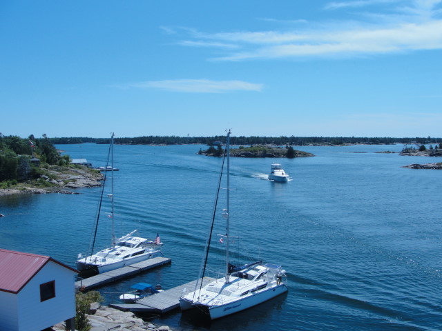
Killarney, founded in 1820 as a fur trading post, and was not connected to the rest of the world by road until 1962.  It is now a major destination for boaters because it marks the end of     Georgian Bay and has many marinas to take on fuel, water, and supplies. 
After we finished our chores including three loads of laundry, we headed to the Pub for well deserved refreshments.  Dinner ashore tonight was a treat since this is our first marina for a full week! 
 SUNDAY,  JULY 22nd  -  MILL LAKE ANCHORAGE


Trip Day:
   133
Latitude:
  46°00.09 ' N 
Locks Today:
  0
Miles Today:
     51
Longitude:
081°13.42' W
Locks Total:
81
Total Miles:
2,678
Location:
Mill Lake Anchorage


Sunrise at our anchorage was well worth a photo this  morning.  Light winds were predicted today so we left our anchorage at 7:30 and motored out Byng Inlet. Once we cleared the Northeast     Passage, we raised our sails and crossed open water with a compass  heading of 260°  as we sailed toward the horizon.  This  section is the most exposed portion of the trip up Georgian Bay so we were glad the weather cooperated making for a beautiful day on the water. 

Reaching Toad Island, we sailed into protected waters of Beaver Stone Bay.  Passing into Collins Inlet the small rock islands have morphed into much larger, higher rock hills which are heavily treed.   As we entered Mill Lake we were once again greeted with remarkable scenery. 


We saw very little boat traffic today, but on Mill Lake there was a group of campers and Mill Lake Lodge which seemed to have a lot of activity.  We have been gunkholing for a full week -  tomorrow we head into a marina for groceries, beer, laundry and free Wifi! 


Factoid:  We crossed 46 degrees latitude today.  .  .
  Changes in Latitude!


SATURDAY,  JULY 21ST  -  BYNG INLET


Trip Day:
   132
Latitude:
  45° '46.16 N 
Locks Today:
  0
Miles Today:
     18
Longitude:
080°' 34.27W
Locks Total:
81
Total Miles:
2,627
Location:
Byng Inlet Anchorage


Northern Pike for breakfast!  Ron has been trying multiple jigs, lures, and spoons trying to attract these northern fish with no success.  Last night I looked in his tackle box, pulled out a 5” ugly old lure and said, “try this ugly thing”.  The very first cast he caught a Northern Pike!  Unfortunately it appeared it was the only fish in our little anchorage cove.  But it was enough for the two of us to have fore breakfast. 

 Each morning one of our first duties on the boat is to clear all the spider webs.   Spiders are very industrious    workers and I suppose we should appreciate their fine spinning skills, however, we are quite sick of clearing webs every day. 


This part of Northern Georgian Bay required us to sail outside the protection of rock islands in open water where we are unable to see the southern shore.  The morning was delightful, light winds, which allowed us to fly sails and turn off the motor.  Strangely we still had to follow a channel due to unseen rock hazards.

 By 10 o’clock the winds had increased, whitecaps were predominate and we had to make a decision to duck into Byng Inlet or continue for three hours to the anchorage we had selected for the day.  We called Marc and Betty (KatMan2) on the VHF and a joint decision was made to enter Byng Inlet and wait for better weather. 

A dinghy ride into the local general store which was licensed to sell beer and wine was the highlight of the day.  We took advantage of the easy afternoon to read and enjoy life in the slow lane. 


FRIDAY,  JULTH 20th  -  BIG BURNT ISLAND


Trip Day:
   131
Latitude:
  45°38.25 ' N 
Locks Today:
  0
Miles Today:
     28
Longitude:
080°33.19' W
Locks Total:
81
Total Miles:
2,609
Location:
Big Burnt Island Anchorage


Point Au Baril Lighthouse proved to be an interesting place to visit and Ron snapped a couple of nice photos from the observation deck.  Emmaline, the last lighthouse keeper gave us a tour and showed us historical records and photos taken when the logging  industry was in full swing and when Point Au Baril was a destination with a resort hotel.  Emmaline and her first husband raised their family of four children while  living in the lighthouse. 


She shared stories of the school boat stopping by to pick the kids up to take them to school—quite a unique life!  We took the opportunity to quiz these folks on the facts of just how the people in houses on the rock islands   managed.  Most of the houses now have hydro by underwater cable and they pump water from the bay. There is no way to have an underground    septic field, so the houses have above-ground holding takes and once a year the pump-out boat services all the island residences.

Another day of picking our way through the thousands of rock islands and interesting little coves.  It took a bit of looking, but we managed to find a little cove with 8-10 feet of  water in which to anchor for the night. Ron looked at charts and confirmed our course for tomorrow while Jean uploaded photos, updated the log and blog, then prepared dinner. Yet another wonderful day of extended    vacation!

 Remember.  .  . you can spot us on Google Maps by clicking Location:  Killarney in the footer below.