Friday, July 20, 2012

GEORGIAN BAY - DELIGHTFUL!

THURSDAY,  JULY 19TH  -  SNUG HARBOUR


Trip Day:
   130
Latitude:
  45°22.68 ' N 
Locks Today:
  0
Miles Today:
     25  
Longitude:
080°78.67' W
Locks Total:
81
Total Miles:
2,581
Location:
Snug Harbor


Being in no hurry, we took time to do a little  waxing on the boat this morning before lifting anchor at 9:00.  We were lead boat today, so   KatMan2 followed our wake safely.   Jean steered most of the way while Ron served as navigator, checking charts and sighting rocks.  We survived several very skinny passages and pencil-narrow channels.  From a distance, it looked impossible for us to clear the markers, but we took it slowly and, of course, we did have clearance. 

The small granite  islands, winding course, and narrow passages continued to delight the senses as we pick our way through Georgian Bay.  Studying some of the rocks is like watching clouds—we could find animal shapes.  Can you see the elephant lying on its side at the bottom right in this rock?     
Pulling into Snug Harbor, we decided to anchor for the night and check out this lighthouse.    After a short rest and chart-plotting session we took off in the   dinghy to explore our new surroundings.  We were not disappointed-the narrow little cuts had amazing rock formations with grooves and ripples, each unique and beautiful!


WEDNESDAY, JULY 18TH - THREE FINGERS BAY


Trip Day:
   129
Latitude:
  45°11.83 ' N 
Locks Today:
  0
Miles Today:
     12
Longitude:
080°05.74' W
Locks Total:
81
Total Miles:
2,556
Location:
Three Fingers Bay

One could safely say that we are taking our time to enjoy the views.  We hosted anchor at 9 a.m., ran for about an hour, then tied up on the docks at Henry’s, which has been recommended by many for their Pickerel fish dinners.  Since we were early for lunch, we took off on a hiking trail, making lots of noise due to reports of bear in these woods.  Lunch was a treat—fish, fries, coleslaw and beans all served family style—the four of us ate enough for a big family and agreed it was a good stop for lunch. 

KatMan2 was lead boat today, so we sat back, followed their path with no pressure to spot rocks or ensure the proper course.  They didn’t hit any rocks, so we didn’t hit any rocks—simple!                      

The scenery in Georgian Bay continued to amaze us.  We have seen at least 500 of the 30,000 islands, but each area brings its own beauty and character based on the color of the granite, the angles or smooth edges, and the homes built on the multitude of little islands.  The charts for the North Channel are interesting with the scattered islands and rock formations and essential to stay on course and off the hard surfaces. 

We anchored in Three Fingers Bay with a lovely view, but decided not to swim after Ron sighted this snake just off the boat.   A couple hours later Betty L arrived with their daughter Stephanie on board—we welcomed them and invited everyone aboard Latitude Adjustment for dinner.  


TUESDAY, JULY 17TH - BOWES ISLAND

Trip Day:
   128
Latitude:
  45°05.55 ' N 
Locks Today:
  0
Miles Today:
     34
Longitude:
080°05.39' W
Locks Total:
81
Total Miles:
2,544
Location:
Bowes Island, ON

Weather forecast for today included the words .  .  . “strong wind warnings” and when I awakened at 5:00 to the sounds of wind and halyard slapping I thought we might be spending the day at the dock.  By 8:00 it appeared reasonable to venture into Georgian Bay and as soon as we cleared the marina breakwater, leaving behind the mural-painted grain silos, the sails were raised and the engine was silent.  I can’t say it was peace and quiet—we were sailing 7.5 to 9.0 mph on the gusts—the rushing, sluicing  sounds as we cut through the water were exhilarating.  As the 20 kt gusts hit, driving the nose of the boat down, we felt we were literally flying across the tops of the whitecaps!  In order to avoid the long fetch of Georgian Bay, we opted to take the alternate route east of Beausoleil Island which provided a wind break through the small islands. 
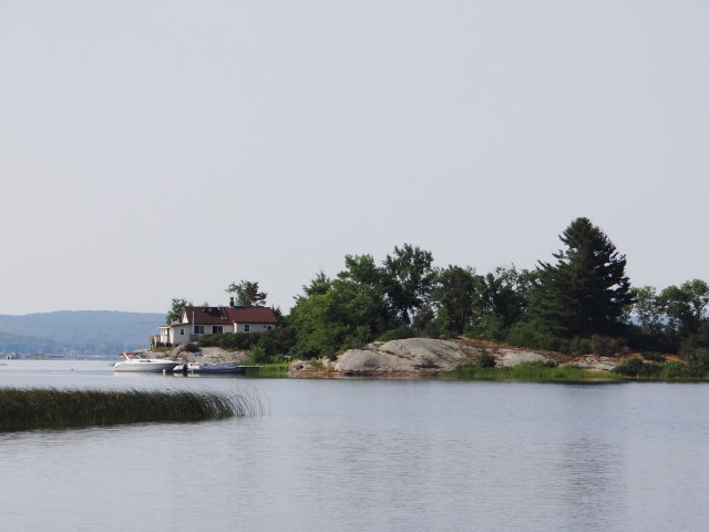
 Expectations were high since people have been telling us “just wait till you see Georgian Bay” for the last month.  We were not disappointed—this area is spectacular!  The glaciers artistically carved thousands of rock islands in all shapes and sizes, smooth, angular, craggy, and graceful.  To our surprise, many of the islands in this area are topped by houses.

 
Many of the passages were very narrow, but well marked.  Most of the small rock islands had buoy markers and then the    channel markers marked our way through the many islands.  Sometimes the depth would  be 50 feet, then drop to 15 in the narrows.  


At exactly 12:05 this afternoon we passed the 45th parallel which means we are now closer to the North Pole than the equator. .  . changes in latitude!  Appropriately, it is cooler today and tomorrow the highs are predicted in the low eighties. 


As we looked for an anchorage this afternoon, we found an area on the chart that looked promising with depths of 15-20 ft surrounded by islands.  This spot is between Bowes Island and Moose Point    Indian Reserve which is a National Parks island.  We inched our way in, Ron on the bow spotting rocks, Jean steering and calling out depth sounder readings, and safely anchored.  KatMan 2 followed our path, anchoring nearby, then confirmed on the VHF that happy hour and dinner were at 6:00 on their boat tonight.  All is right with the world!


Monday, July 16, 2012

VERTICAL MAST - SAILING ONCE MORE!


Trip Day:
   127
Latitude:
  44°39.58 ' N 
Locks Today:
  0
Miles Today:
       0
Longitude:
079°23.10' W
Locks Total:
81
Total Miles:
2,510
Location:
Midland, ON – Bay Port Marina

This was the big day—the goal was simple; get the mast vertical!  We moved our boat into place at 7:30 a.m. and the crane operator was on the job by 7:45. 

BEFORE


Everything went smoothly and fairly quickly to get the mast upright with the crane, then set in place on the mast step.  It took about an hour for James to attach all the stays and shrouds, then tune the rigging, then he tackled the wiring. 


DURING
After our boat was done, we moved back into our slip and KatMan2 took our place at the crane bay.  Then, our work began; removing the sails from the sail bags, hosting the jib, screecher and finally the mainsail.  It took us over 5 hours to get all the sails rigged, dismantle the mast cradle and scrub the deck.  The temps were in the high 90s again today so by the time we finished our work, we were         finished! 
AFTER


The group decided to stay in the marina again tonight and we headed to the pool with our cooler and snacks in hand. 


Tomorrow we will head out, hopefully under full sails and begin exploring the thousands of granite islands in Georgian Bay. 


Sunday, July 15, 2012

GEORGIAN BAY / MIDLAND, ON


Trip Day:
   126
Latitude:
  44°39.58 ' N 
Locks Today:
  0
Miles Today:
       8
Longitude:
079°23.10' W
Locks Total:
81
Total Miles:
2,510
Location:
Midland, ON – Bay Port Marina

This morning we pulled into Bay Port Yachting Centre in Midland, ON which is quite nice and has a swimming pool we plan to visit this afternoon.  Today we will take care of chores, buy groceries, do laundry, exchange propane tanks and clean .  .  . Tomorrow  the crane operator will raise our mast!!  We have looked forward to this day anticipating sailing through the 30,000 islands of Georgian Bay. 

Brown Eyed Girl and Kismet are also here - unfortunately these boats are here for repairs after hitting rocks.  Brown Eyed Girl has to have a new shaft and props and Kismet also requires fiberglass work to repair a large gash. 


SATURDAY, JULY 14TH - PENETANGUISHENE ON

Trip Day:
   125
Latitude:
  44°47.94 ' N 
Locks Today:
  1
Miles Today:
     21
Longitude:
079°56.10' W
Locks Total:
81
Total Miles:
2,502
Location:
Penetanguishene, ON

Locking through the last lock and bridge of the Trent-Severn Waterway was bittersweet—hate to be leaving the TSW, but looking forward to Georgian Bay.  Passing under this bridge gave us our first glimpse of Georgian Bay and what a nice welcome she gave us. 


As we wound through  narrow channels following the marks we awaited the open water and, since it is Saturday, we were not surprised to see boats of all sizes headed out for a day of fun on the water.  It did not escape Ron’s attention that there were sailboats with their mast in a vertical position and under sail—just a couple more days and our mast will be upright again.                

We passed Snake Island, Present Island and Peekaboo Point as we rounded into Penetang Harbour to Penetanguishene where we went ashore to tour Discovery Harbour, which is the site of the Naval Establishment of the War of 1812.  Georgian Bay area will be hosting numerous events to celebrate the Bicentennial of the War of 1812.                

Since Canada was still a province of Great Britain, it was used as  staging area for the British troops during the War of 1812.  Replicas of the structures on the original base were on display including officers’ quarters, commanding officer’s and the  Fort Adjutant homes. 
 The

H.M.S. Tecumseth was an armed transport schooner stationed at this naval base from 1816  to 1828—by the time it was launched, the war was over.   The replica of this 70ft schooner was well done—the most   intriguing feature was the tiller steering station (there was no wheel).  
The British hydrographer, Henry Bayfield, worked from this base when he surveyed Lake Huron for the British Navy.


FRIDAY, JULY 13TH  -  THE BIG CHUTE!

Trip Day:
   124
Latitude:
  44°51.51 ' N 
Locks Today:
  1
Miles Today:
       4 
Longitude:
079°42.64' W
Locks Total:
80
Total Miles:
2,481
Location:
Gloucester Pool
Early morning photos at Lost Channel anchorage.


The Big Chute, lock 44, is the most unique and hair-raising experience on the Trent-Severn.  It is not technically a lock, but actually a railway lift, with a 58 ft drop, over the land between  the Upper Severn River and Gloucester Pool.  The Big Chute railway portages vessels across land and down the chute on twin tracks.   There are two different stories for the railway portage versus lock portage.  One story is that there was no concrete available for a standard lock and the railway was cheaper.  The other was to prevent lamprey-a parasitic, eel-like fish with a jawless, sucking mouth from attaching itself to other fish and damaging the fisheries in Lake Simcoe. 

We arrived at The Big Chute early, tied up to the dock and went ashore to watch operation    before venturing across ourselves.  As we approached the dock Ron spotted The Tarquin which is the trawler owned by Sandi and Eddie from Bradenton whom we met before we left Sarasota.

This is the first time our paths have crossed and it was so exciting to talk with them—we will most likely meet again in Georgian Bay. 
 
We watched a couple of boats pull into the submerged rail platform, lifted on slings as it rose out of the water, transported across the land and down the slope, then drive into the lake once the platform was submerged again. 


And then it was our turn .   .   .  We drove into the open-air carriage and rested on our hulls with no straps as we slowly made our way across the street, and down the chute, one cog at a time.  The ride took about 10 minutes and was stable, but the sounds of the squeaking cables and  pulleys and unidentified grinding sounds made for an exhilarating ride.


Looking back as we motored away, we wanted to turn around and go through again, but the Betty L and KatMan2 were waiting for us so we could move on down the river.
Traversing through the tree-lined narrows of granite we were rewarded when it opened up to yet another beautiful area with little   islands and cottages and boats of all sizes.  We followed the Betty L into a little cove off a Canadian public park.  We spotted a tent camper tucked back into the trees very near our anchorage.  As soon as the hook was set we were in the refreshing water, Jean jumped in with her clothes on, then we all floated around on noodles chatting about the day. 
While we had dinner on the Betty L, a helicopter landed just beyond our anchorage causing much speculation about which hockey player had a weekend home here, or perhaps it was a rock star!


Friday, July 13, 2012

THE LOST CHANNEL

THURSDAY, JULY 12TH  -  THE LOST CHANNEL ANCHORAGE - DAY 123


The play at the Opera House last night was a murder mystery spoof with a LOL approach and proved to be very entertaining.  The four of us were front row with our feet literally on the stage and the action 8 feet in front of us—an interesting perspective.  As we left the Port of Orillia Marina this morning, the weed eater was in operation trying to maintain the weed growth in the dock area.  The water is so clear you can see the bottom at 15 feet, but the weeds grow 4 feet long.  Leaving the   marina and crossing Lake Couchiching, we entered the Severn River which is  the final stretch of the Trent-Severn.   Marc and Betty have returned, so we were three boats in a row this morning.

  Amazing scenery  surrounded us; the trees were tall and full with lush   summer growth.  The pines, firs and evergreens were abundant with  maple and birch trees  scattered  throughout.   


Today was one of the busiest days on the TSW with boats ranging from canoes to motor yachts to cruise boats.  The locks required patience and careful boat  handling as the lock tenders loaded the locks with as many boats as  possible to  accommodate the heavy traffic. 


At Lock 42, a couple greeted us by name;  welcome Jean and Ron on   Latitude           Adjustment.  They have been following our blog and ecognized the boat name.—how amazing is that?!


This section of the river is populated with homes and cottages and some places have all the toys—docks, boats, slides and seaplanes. 


It was a day of beauty—calm water, trees, rock islands, people waving hello from the shore and friendly conversations with other  boaters in the locks.


McDonald’s cut was one of the last sections of the TSW to be completed in 1905.  The cut is narrow and winds through cliffs of solid granite.  Imagine excavating this cut by hand with no machinery—we  appreciated the effort of those who had the vision and determination to make this possible.

 
The final lock of the day was Lock 43 at Swift Rapids which was a 47 foot drop into the dark cavern. 
 At marker S115 our three boats turned right to anchor in the area known as The Lost Channel and within minutes of    setting the hook we were in the water for a refreshing end to our day of travel. 

Dinner was on KatMan2 last night with all of us bringing        something good to the table.  We ended the night with Betty’s homemade chocolate chip cookies and a shot of Quarenta y Tres with cream floated on top. 

Every day we are grateful to be on this adventure!