Monday, May 7, 2012

NORFOLK (NAW-FUK) - DAY TWO


Trip Day:             64   Latitude:            36°50.63' N              Locks Today:  0
Miles Today:          0   Longitude:      076°17.53' W              Locks Total:   8    
Total Miles:    1,271   Location:        Norfolk, VA  /  Waterside Marina

It certainly seems that our visit in Norfolk (Naw-fuk) is going to be a pleasant one.
An early morning walk through the renovated waterfront park reminded us of Chicago. Smooth, green bench-lined grass areas, brick walkways, an open-air amphitheater, the U.S.S. Wisconsin, Tall Ships and The Nauticus Museum make up a pleasing and satisfying experience.


  . 


Since the museums were closed, we took off on our bikes to follow the Cannonball Trail to  explore the historic district.  (Thanks again to our co-workers for our bikes!)  The Freemason Historic District with original cobblestone streets was amazing—it definitely makes the “favorite places” list! 


Ron found the Freemason  Abbey Restaurant which was so special with great food, original beamed ceiling and stained glass windows.  Not only did they serve beer, but crab cakes over wild rice and black bean ragout completed our experience!


There are 34 trawlers/cruisers and 3 sailboats in this basin flying the AGLCA flag.  We were pleasantly surprised by the other sailboats, especially since one of them is a Gemini Catamaran just like ours!  Tonight we are off to the Sheraton for dinner, sponsor displays, and meet and greet sessions.

Sunday, May 6, 2012

NORFOLK, VA - AGLCA RENDEZVOUS


Trip Day:              63   Latitude:            36°50.63' N              Locks Today:  0
Miles Today:         1    Longitude:      076°17.53' W              Locks Total:    8         
Total Miles:       1,271   Location:         Norfolk, VA  /  Waterside Marina

Last night when we returned to the boat after the dinner theater, we had to wade through water to board the boat.  Thank goodness we had been warned that at high tide the lower dock would be underwater, but still a very strange feeling.  This morning was high tide again so we rolled up our pant legs and went off to breakfast. 


We left the Portsmouth ferry basin this morning, crossed the river to Norfolk’s Waterside     Marina which will be our home for the next five days while we attend the AGLCA Spring Rendezvous.  The riverfront has a beautiful park, several restaurants and museums.  It appears there are about 25 boats here for the rendezvous. 


Ron is one happy man - lunch at the Bier Garden which had an 18-page menu of just beer! 

Check us out on the google map location below.

PORTSMOUTH, VA

Saturday - May 5, 2012
Trip Day:              62  Latitude:             36°50.12' N              Locks Today:  0
Miles Today:          9   Longitude:      076°17.80' W              Locks Total:   8         
Total Miles:    1,270   Location:        Portsmouth, VA / High Street Ferry Dock

After being in the quiet serenity of the swamp, we faced culture shock when we entered the South Branch of the Elizabeth River.  We fell into a line of boats headed north on the ICW.

A group of us waited for the center span of the railroad bridge to rise after a train had passed.


The river became increasingly more industrial as we approached Norfolk and the Naval presence was clearly evident.


There was just enough room for us to tie up to the docks at High Street Ferry Landing in  Portsmouth, which is on the west side of the river across from Norfolk. There were five other boats in the little basin which is on Water Street in the heart of the historic district which will allow us to do a little exploring. 

We strolled tree-lined streets with old brick sidewalks and homes listed as circa 1750.


The Portsmouth Lightship was in service between 1916 and 1958.  The lightships would anchor at the entrance of major shipping ports (too deep for lighthouses) for 10 to 12 months until a replacement ship relieved the crew of 4   officers and 9 enlisted men.  For the time period, she had cutting edge features; electricity and a hollow mast which allowed the crew to climb inside the mast to refill the kerosene tank for the lamp, far less dangerous in rocking and rolling seas. 

                               
The ship used huge mushroom anchors with very heavy chain, each link weighing 20 pounds.  Large struts locked the chain in place and served to stabilize the ship.


We had dinner and watched a movie at the art deco Commodore theater built in 1945.  The lavish interior with a huge stage, art deco ceiling trim, murals on the walls, comfortable chairs and tables, and a phone to place your order all made for a fun night! 

With the super moon the tide was super high so we had to roll up our pants legs and wade through water covering the dock to board the boat.

Friday, May 4, 2012

CHESAPEAKE, VA

Trip Day:            61      Latitude:          36°44.36' N              Locks Today:  1
Miles Today:        5     Longitude:      076°17.78' W              Locks Total:   8         
Total Miles:      1,261     Location:        Chesapeake, VA – Top Rack Marina/ free dock


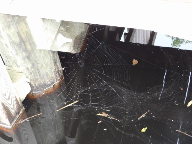
Resident spiders left evidence of their handiwork on the dock, our docking lines and the backstay overnight. 


The Deep Creek lock tender, Robert, invited us for coffee this morning so our first order of business was to make biscuits as our contribution.  With our duffle packed with biscuits, butter, jam and honey we joined Robert for breakfast and another history lesson on the Great Dismal Swamp.  Robert is very much a history buff and a tour guide for the Dismal Swamp and Chesapeake area having lived here all his life. 


After some good tips on restaurants, entertainment and places to see in Norfolk, it was time to leave Robert and the Dismal Swamp behind.  We locked through Deep Creek at the 11:00 a.m. opening and noted with interest that we are now closer to New York than Charleston. 


Having exited the swamp and rounded the bend , the Dismal Swamp route meets Albemarle & Chesapeake Canal which is the other route north from the Outer Banks.  A line of trawlers who opted for this faster paced route immediately emerged.  It was quite a shock after having been in the slow lane of the Dismal Swamp for three days. 


In need of fuel and water we are staying the night at Top Rack Marina where we can stay for free with utilities as long as we eat at the Amber Lantern Restaurant .  .  . An offer we can’t refuse.

 Tomorrow we are off to Portsmouth, VA to explore the western branch of the Elizabeth River across from Norfolk.   


You know the drill .  .  .Google map us by clicking on the address after Location in the footer below.  Over and Out!

Thursday, May 3, 2012

WELCOME TO VIRGINIA!

Trip Day:          60      Latitude:            36°44.73' N              Locks Today:  0
Miles Today:     17      Longitude:      076°22.48' W              Locks Total:   7         
Total Miles:    1,256      Location:        Chesapeake, VA – Deep Creek Lock/ free dock


Another day in the Dismal Swamp dodging logs which are difficult to spot due to the trees reflected in the water.  The state of Virginia welcomed us at mile marker 25.


Tomorrow we will lock through the Deep Creek Lock and depart the Great Dismal Swamp .  .  . here are a few scenes from today.


This afternoon we tied up to a free dock just before the Deep Creek Lock which we will pass through tomorrow.  We are in Chesapeake, VA which is 11 miles from Norfolk. 
A bike ride into town for dinner at a local restaurant and a trip to the grocery concluded another great day.  

Wednesday, May 2, 2012

DISMAL SWAMP VISITOR CENTER


Trip Day:          59      Latitude:            36°30.41' N              Locks Today:  0
Miles Today:     15      Longitude:      076°21.36' W              Locks Total:   7         
Total Miles:    1,239   Location:        Dismal Swamp Visitor Center / free dock


Yesterday we established that the Dismal Swamp Canal was dug by slaves and completed in 1804.  The canal had an immediate impact on the local economies allowing transport of lumber and goods between northern and southern colonies without ships having to venture into the Atlantic or cross the wide-open sounds.

 The canal truly is just a straight ditch—it has its beauty—but also its peril.  We were glad to be third in line so the wakes of the boats ahead of us could push the partly   submerged logs out of our way.  


In 1862 when the Confederates were caught in the Union Army blockage of coastal North  Carolina, the canal offered a supply route to Confederate strongholds in Virginia.  The Dismal Swamp also played an important part in the Underground Railroad, where escaped or freed slaves established “maroon colonies” deep in the swamp until they could escape to  freedom in the north.
 The Dismal Swamp State Park had an interesting museum of the history of the swamp.  The Park has miles of hiking trails with tent camping.  We took a short hike on the raised wooden walkways, but the only wild life we encountered was this enormous, long, slimy, slithery,  green snake, which I am sure serves a good purpose in the ecosystem, but a snake nonetheless!


Google Map us by clicking on Dismal Swamp Welcome Center in footer below!


Tuesday, May 1, 2012

ENTERING THE DISMAL SWAMP / SOUTH MILLS


Trip Day:          58      Latitude:            36°26.58' N              Locks Today:  1
Miles Today:     11      Longitude:      076°19.55' W              Locks Total:   7                                 
Total Miles:    1,234   Location:        South Mills, NC                    


No navigational markers were required today as we followed the serpentine Pasquotank River.  The tall, straight, soldier-like cypress trees stood guard on both banks of the river reminding us to pay respect to the nature  surrounding us.  Leaving the river to enter the Turner Cut we were pleasantly surprised that although a man-made straight cut, the forest had survived with its beauty intact. 


As we approached South Mills Lock one other sailboat was at anchor awaiting the 11:00    opening for the eight foot rise.  By the time we locked through there were a total of eight boats, equally divided sailboats and trawlers. It seemed to take forever for all the boats to be secured by the lock tender and then the gates opened to allow the lock to fill and rise eight feet.  Just when everyone was ready to begin the exit processional, the lock tender announced that “something broke” and the gate was stuck in the closed position.  Repair took only about 30 minutes to allow one side of the gate to open. 


Officially in the Dismal Swamp, dawdling along, with five days to travel only 33 miles to Norfolk.   So, a little history .  .  .  The Dismal Swamp Canal is the oldest operating canal in the United States.  George Washington, who owned 40,000 acres of  timber land,  surveyed the canal and Patrick Henry was Governor of Virginia in 1784 when the canal was first proposed.  Digging by hired slave labor began in 1793 and completed in 1804.


 History to be continued tomorrow.  .  .